One of the most ambitious projects when it comes to racing games was The Crew. It allowed players to explore the entire vast map of the USA! You could start your journey from Los Angeles and drive all the way up to New York. The best part was the game wasn’t just a barren land and there were many iconic locations that you could come across. So it is only natural that players wonder just how big the map size is of The Crew 2.
While in the original game, you could only drive around. The successor went a step ahead and this time let you hit the water or skies using boats and planes. This opens up room for even more exploration. This brings up many questions like how long would it take you to traverse the whole map, what are the major differences, and more. That’s why here is the comparison of maps of both the games.
How Big is The Crew 2 Map
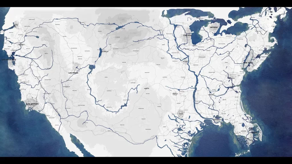
The Crew 2 map should be anywhere between 5000-7000 Km square. The reason for it is both the games share the same map. So comparing the sizes of both you should get this answer. Thanks to The Crew Fandom Wiki for these numbers.
Now, you might be wondering if they both have the same map then what changed? Well for starters they added more means to explore as mentioned above boats and planes. They have improved the driving physics a lot from the first game. Of course, the graphics are also better. You also get more vehicles to use. Finally, the police are missing in Free Roam.
The Crew Vs Crew 2 Map Differences
One of the biggest things that the fans don’t like about this game is its removal of iconic places. There are several small towns and landmarks missing that were actually present in the original game. Some have also been changed. Shoutout to the YouTuber GREENY for making a video that shows you all these changes. I suggest you give their video a check.
For now, here are the major location differences:
Removed Areas
- A Part of Canada
- Ambassador Bridge
- Arlington County (Pentagon still is present)
- Chicago Airport
- Glacier City
- Hancock City
- Hope City
- Mexican Border
- Military Base
- Mitchell Bridge
- Paul Bunyan
- Random Motel
- Shoreline Fair
- Some Oval Tracks
- Some Pit Mines
- St. Louis Suburbs
- Trump Wall
- USS Intrepid
- Vandenberg Air Force Base
Downgraded Areas
- Hollywood Walk of Fame
- Salem City
- Ski Resorts
Replaced Areas
- Fort Ross replaced with a Gas Station
How long Does it Take to Drive Through The Entire Crew 2 Map?
There are a lot of factors that come into play here and it isn’t a direct answer. From the vehicle you use to the road you take. But on average, you should take anywhere around an hour or more to reach from one end to another. Of course, you could go faster if you don’t go off track, have a good vehicle, and aren’t affected by other similar factors.
As for flying, if you decide to fly around the whole map and not just from one end to another. Then you should expect it to take you above 90 minutes.
For now, this is all that we have on The Crew 2’s map size. Be sure to check out Gamer Tweak for more such comparisons, tier lists, guides, and more!